
Home / Location / Dublin, Ireland
Dublin buildings often differ from their original drawings. Georgian townhouses become offices, Victorian terraces gain extensions, and commercial buildings change with each fit-out. GeoMaus provides measured building surveys across Dublin, using laser scanning and LiDAR to record existing conditions before design begins. Michael Kiernan manages your project from the first discussion to the final drawings, including scope, survey coordination and quality checks.
Your team receives the agreed floor plans, sections and elevations, as-built drawings in AutoCAD and PDF, or a Revit model. Send the building type, survey areas and intended use of the drawings so we can agree the scope for your Dublin project.
Typical projects: Georgian Townhouses | Protected Structures | Office Fit-Outs | Retail Units | Hotels | Industrial Plants | Residential Extensions | Change of Use
Dublin buildings often predate the drawings on file, or have changed since their last refurbishment. Georgian floors can be uneven, walls out of square, and ceiling heights different from room to room. GeoMaus uses laser scanning and LiDAR to record those variations, so your design starts with measured geometry.
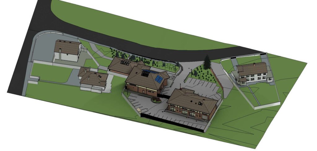
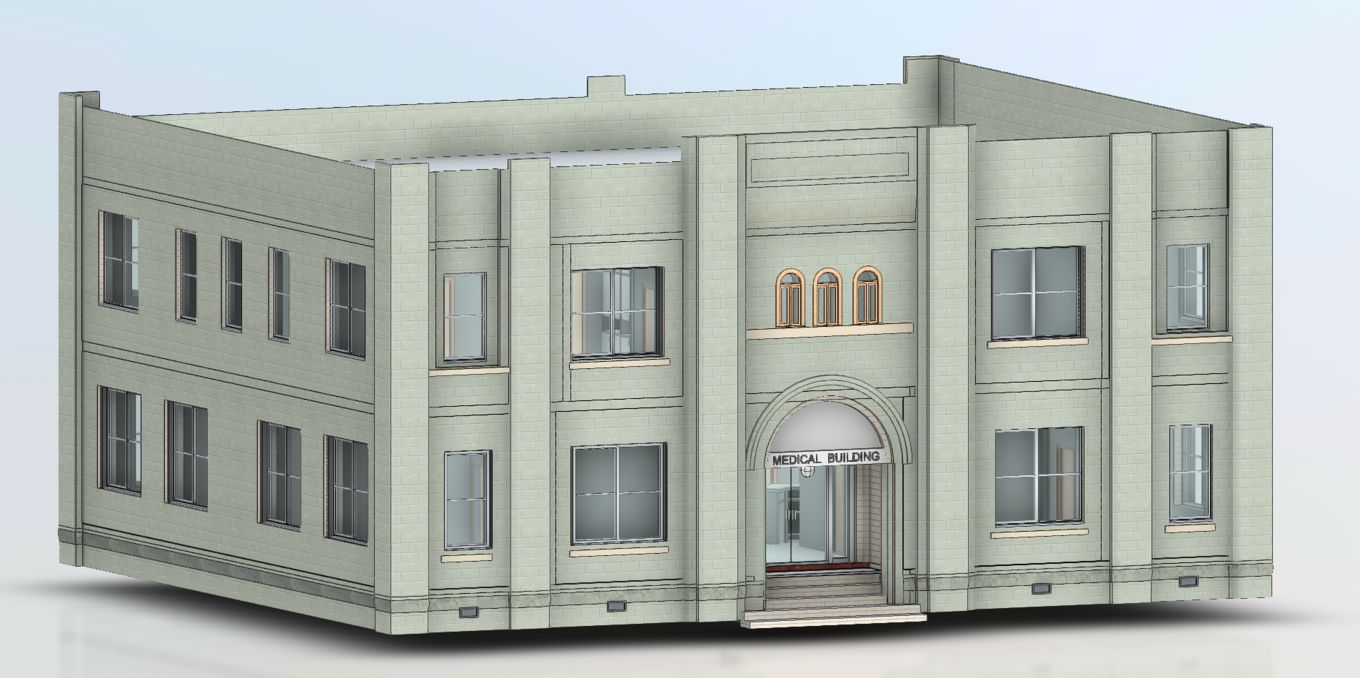
We work with Dublin architects, engineers, developers and property owners planning refurbishments, extensions and changes of use. Our Dublin work includes city-centre retail premises and commercial buildings in Blanchardstown, with the Revit models and drawings shown on this page taken from those projects.
Survey enquiries can cover the city centre, Ballsbridge, Rathmines and Ranelagh, Dún Laoghaire and Blackrock, or Blanchardstown and Swords. We agree access, coverage and drawing requirements for each building rather than assuming that every project needs the same package.
Architects and conservation teams: measured building surveys for Georgian houses, protected structures and residential extensions. Plans, sections and elevations record the existing geometry before design decisions are made.
Developers, retail and hospitality teams: as-built documentation for office fit-outs, shops, restaurants and hotel refurbishments, with coverage agreed around the proposed works.
BIM and engineering teams: scan to BIM models for coordinated design. Laser scanning is the measurement method; your brief determines the model detail and outputs.
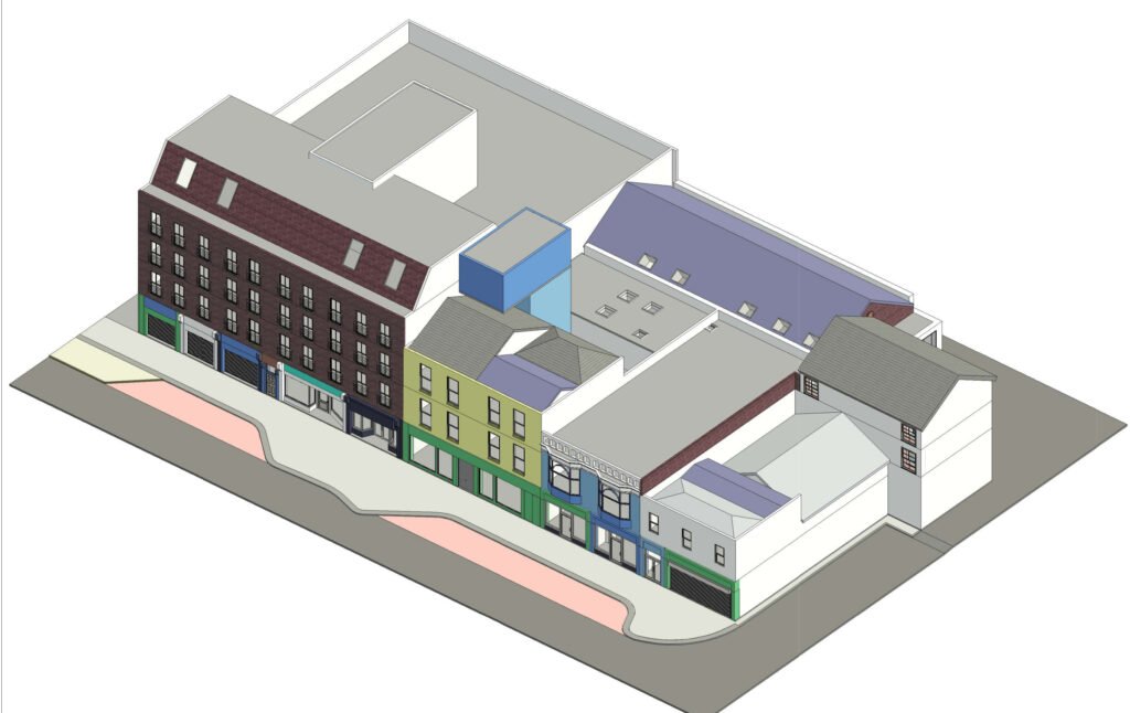
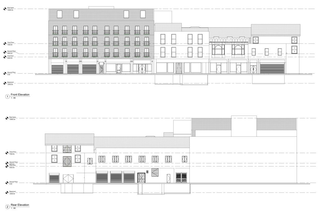
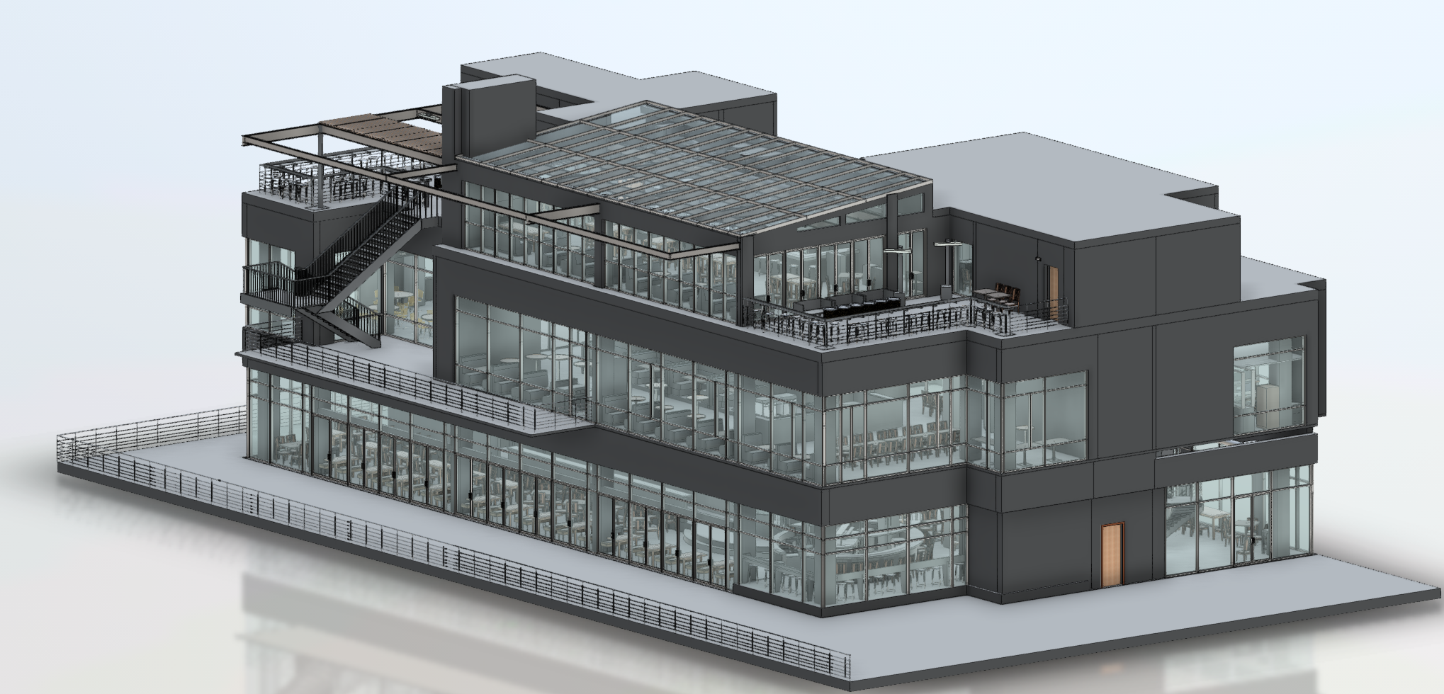
Owners and remote design teams: Matterport tours add a visual reference alongside the drawings. The city-centre retail example below shows a Dublin project recorded as a Revit model, site plan and elevations.
Every survey starts with a 3D laser scan of the building, registered into a single point cloud and then drawn up in the format your team designs in: AutoCAD DWG, PDF or Revit, with IFC available for teams working in other BIM software.
Scope is agreed before we arrive. A planning application may only need existing floor plans, a few sections and the elevations; a full refurbishment may need a Revit model built to an agreed level of detail (LOD), with MEP services included where the engineers need them.
Floor plans, sections and elevations measured from scan data, for planning applications, conservation reports and design work on Dublin buildings of any age.
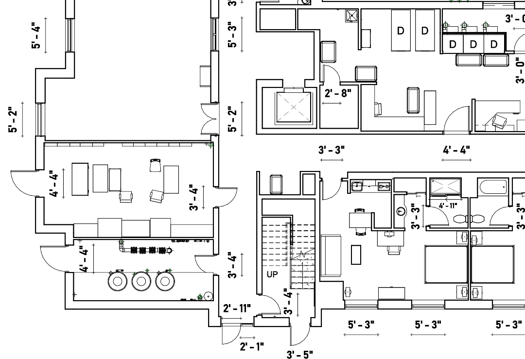
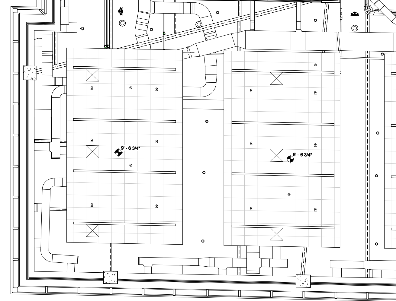
Clean AutoCAD backgrounds and PDF existing drawings, including reflected ceiling plans, ready to drop into a planning or tender set.
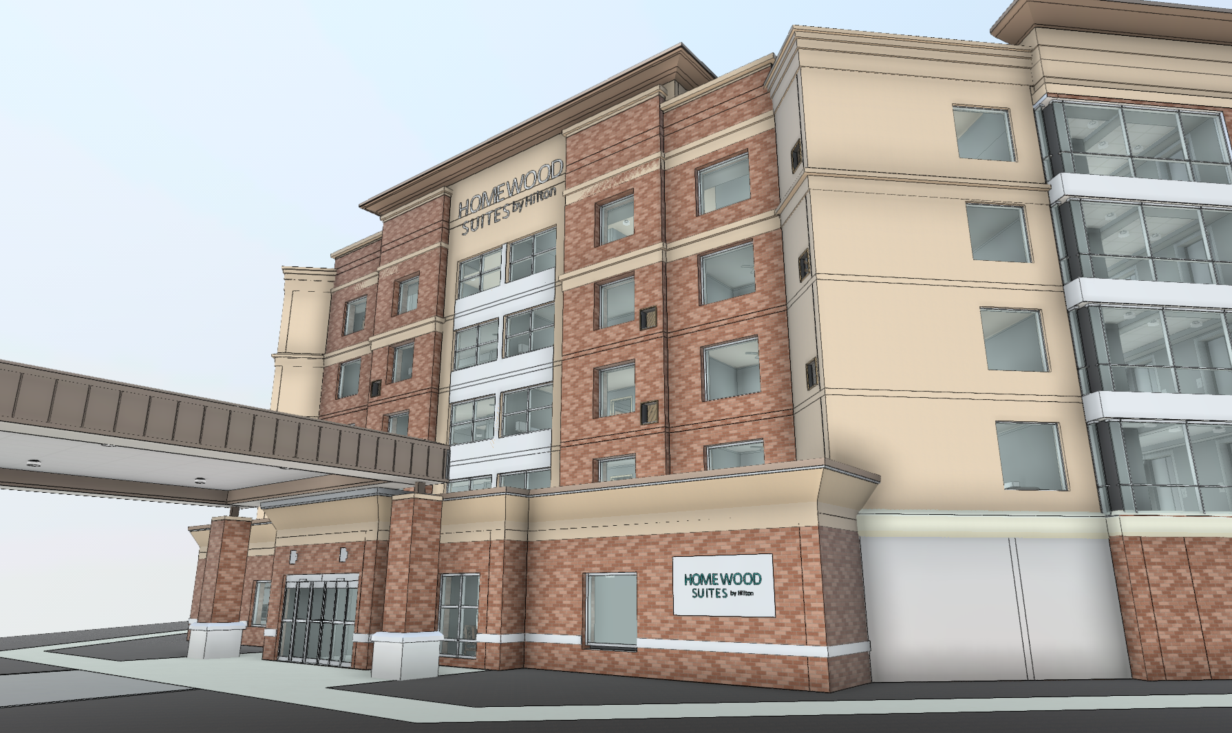
A Revit model of the building as it stands, modelled to an agreed level of detail, for design teams working in BIM on projects across Ireland.
A dated, measured record of a building before or after works, for owners, landlords and incoming tenants who need to know exactly what is there.
Ductwork, pipework, cable trays and plant rooms recorded where they actually run, so engineers can plan upgrades and retrofits from real routes.
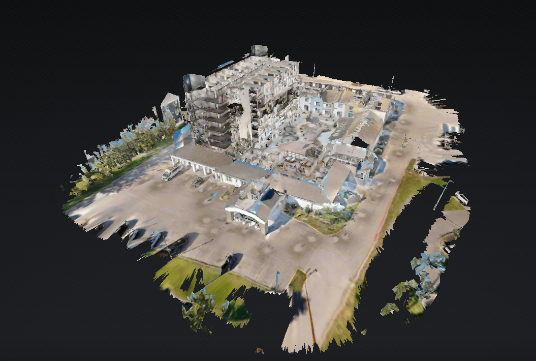
A walk-through 3D tour of the building, so design teams, clients and contractors can check conditions without another site visit.
GeoMaus keeps project communication direct and practical. Michael Kiernan, owner of GeoMaus, works with clients to define the survey scope, coordinate site capture, and establish the deliverables needed for the project.

LOCATION
Dublin city centre, Ireland
BUILDING
Retail building and adjoining streetscape
COVERAGE
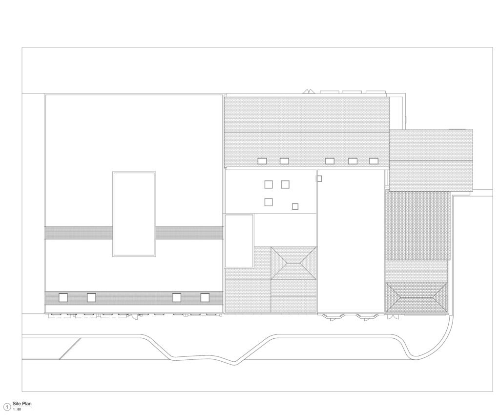
Basement to third floor, plus roof and site context
SCOPE
3D laser scanning, Revit modelling, floor plans, ceiling plans, elevations, sections and site plan
For a Dublin retail design team, GeoMaus documented a city-centre building in Revit and issued CAD and PDF drawings. The drawing set records floor and ceiling layouts, front and rear elevations, sections, roof and site context, giving the team a coordinated existing-conditions reference for design.
Straight answers on measured surveys, protected structures and the files you get back from a Dublin laser scan.
A laser scanner records millions of measured points in every room, so the survey captures walls that are out of square, floors that slope and ceiling heights that change, instead of averaging them out. On our Irish projects, buildings are captured at millimetre-level accuracy, and the drawings and Revit model are checked back against the point cloud before they are delivered.
Yes. Laser scanning is non-contact, so nothing is fixed to or marked on the historic fabric. The point cloud records cornices, joinery, window reveals and wall thicknesses, which gives your conservation architect an accurate base for the drawings and reports that usually accompany a planning application affecting a protected structure.
Planning drawings for an extension, change of use or alteration have to show the existing building, and the proposed design is drawn on top of it. A measured survey gives you existing floor plans, sections and elevations to scale, so the existing and proposed drawings line up and the design starts from the real building.
Scan to BIM turns the point cloud into a Revit model of the existing building. The level of detail (LOD) is agreed at the start: a simpler model of walls, floors, roofs and openings suits early design, while a more detailed model with structure, MEP services and key architectural features suits technical design and coordination. IFC files can be supplied for teams working outside Revit.
Typically AutoCAD DWG and PDF drawings (floor plans, reflected ceiling plans, sections and elevations), a Revit model if you need one, the registered point cloud, and a Matterport 3D virtual tour where it is part of the scope. Everything is delivered in the formats your team already works in, followed by a handover call.
GeoMaus works across Dublin city and county, including South Dublin, Dún Laoghaire-Rathdown and Fingal, and in the neighbouring counties of Wicklow, Kildare and Meath. We also take on projects elsewhere in Ireland and in the UK. Send us the location and we will confirm.
Michael Kiernan, founder of GeoMaus, runs every project personally, from the first call to the handover. He comes from a geodetic engineering background with more than a decade of project experience, and you can reach him directly on +353 83 360 0320. The fieldwork and modelling are delivered by our team, but the scope, the quality control and any decision that affects your programme sit with Michael.
Most enquiries get a same-day reply from Michael directly. If your project isn’t a fit for us, he’ll tell you on the call and point you somewhere better.
No sales calls, no automated drip sequences. Michael replies personally to every enquiry usually within a few hours.