
Home / Location / London, UK
London architects work with buildings that have been altered for a century or more: Victorian terraces with mansard and basement additions, Georgian townhouses converted into flats, and post-war offices that have been refitted by tenant after tenant. The existing drawings rarely show any of it. GeoMaus provides measured building surveys using laser scanning across London and the Home Counties, recording the building as it stands so your team designs from accurate measurements rather than assumptions. Your London project is led personally by GeoMaus founder Michael Kiernan, from agreeing the brief and coordinating site capture to checking the final drawings and model.
From the agreed survey data we produce a measured building survey with plans, sections and elevations, as-built drawings in AutoCAD and PDF, or a scan to BIM Revit model, giving your project an accurate base from RIBA Stage 0 onwards.
Typical projects: Listed Buildings | Conservation Areas | Victorian & Georgian Houses | Basement Extensions | Office Fit-Outs | Retail & Restaurants | Hotels | Mixed-Use Blocks
Much of London was built long before CAD, and most of it has been extended, converted or refitted since. Party walls lean, floors fall towards the back of a terrace, and ceiling heights change between the original house and its later additions. When those details are missed at survey stage, they tend to surface later as redesign or variations on site. GeoMaus uses 3D laser scanning and LiDAR measurement to capture this geometry before drawings or models are prepared.
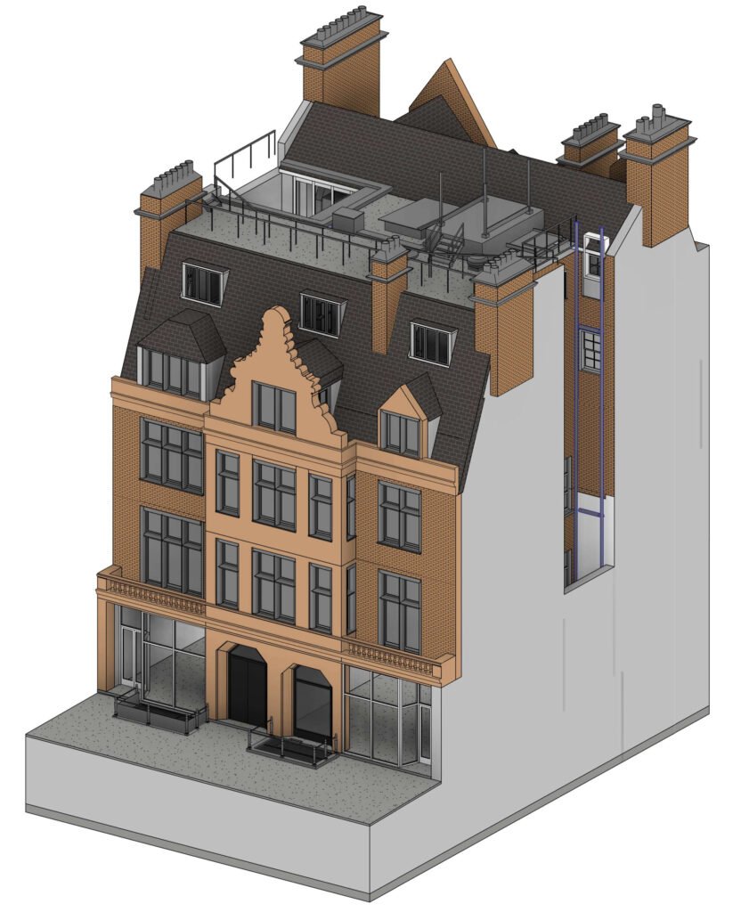
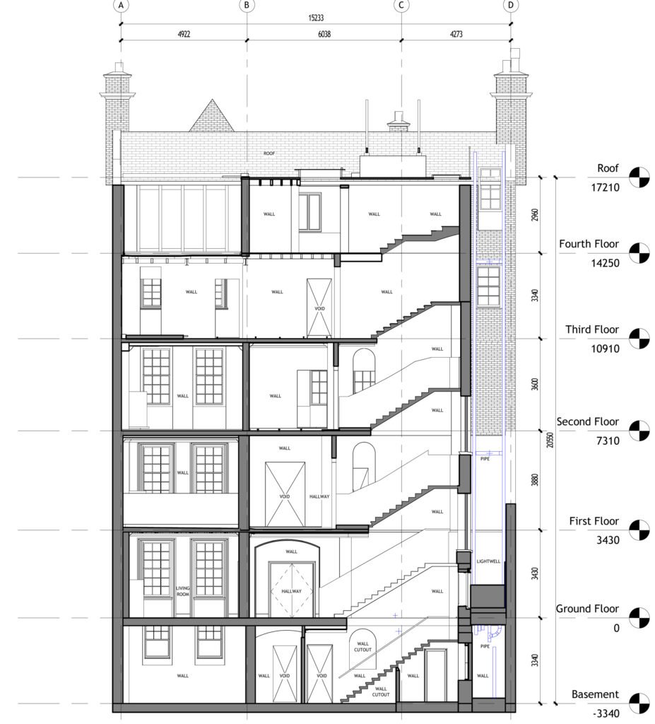
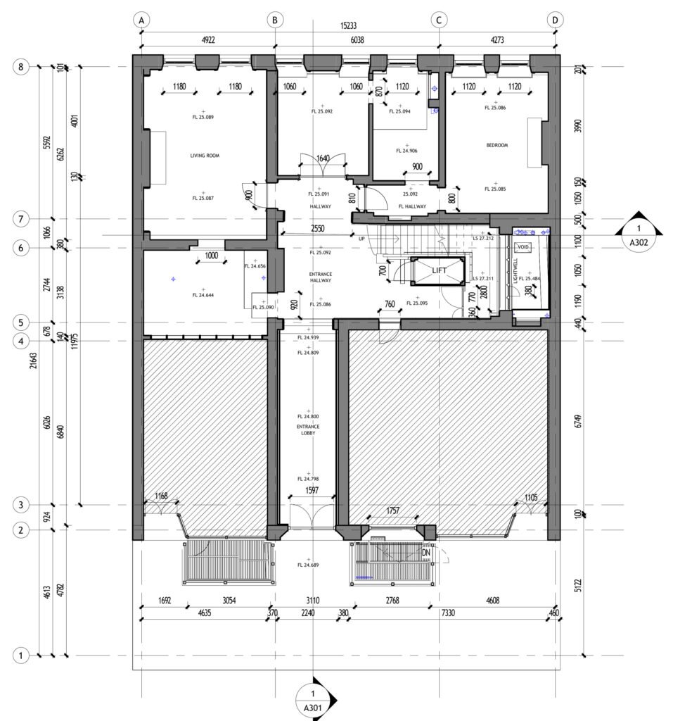
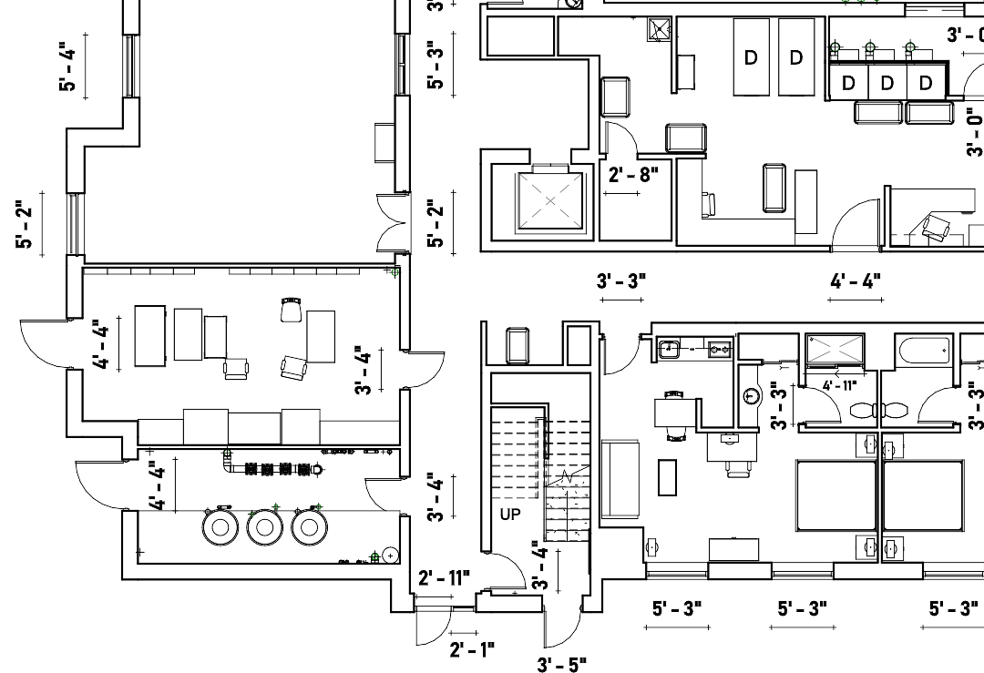
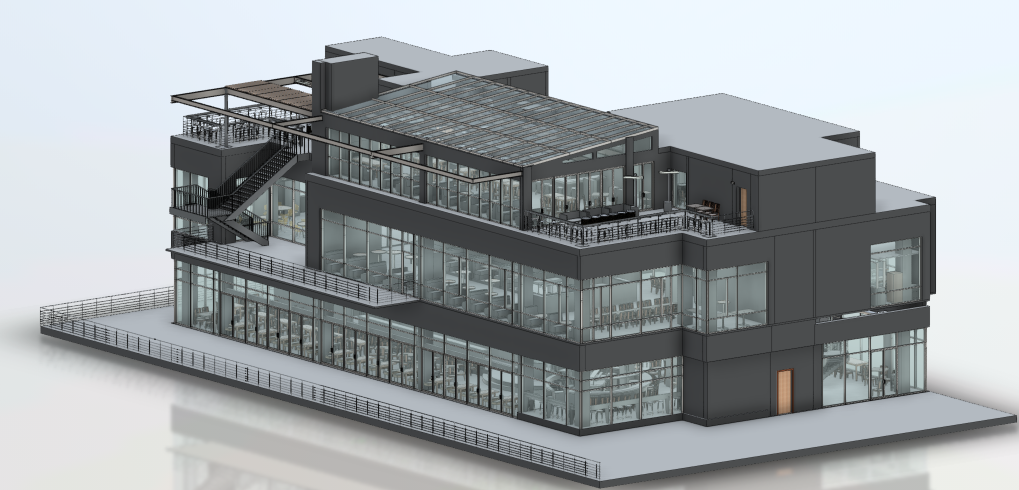
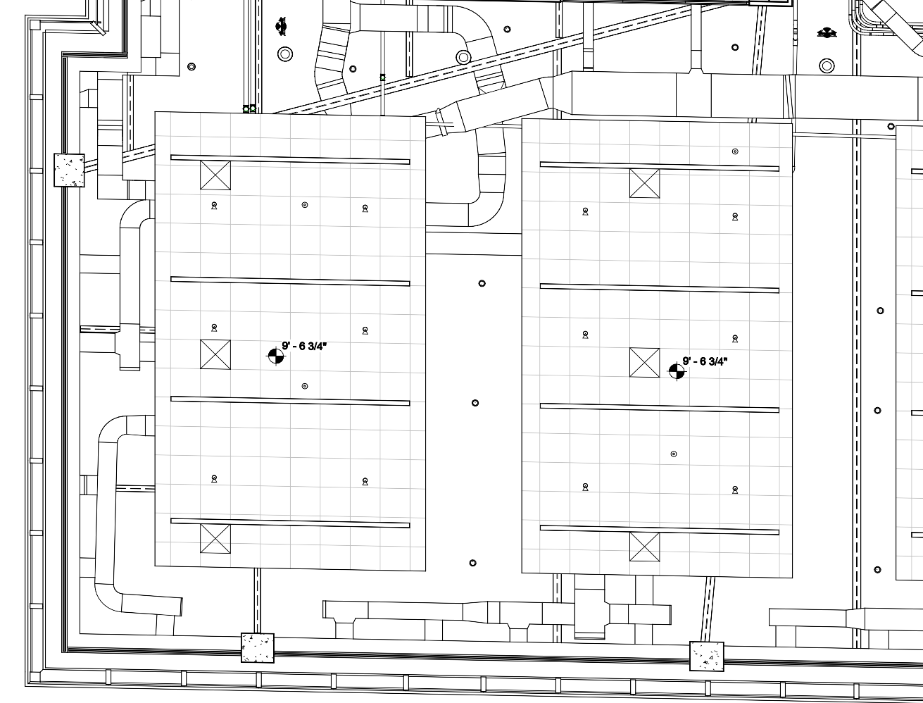
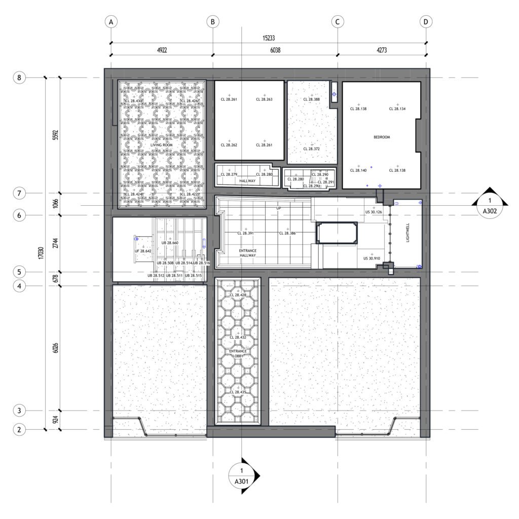
We work with London architects, engineers, developers and property owners preparing refurbishment, conservation and change-of-use projects. Our Mayfair survey work, shown here, includes a Revit building model, floor plans, reflected ceiling plans and sections. The survey brief defines which parts of a building need recording and which drawings the design team requires.
Enquiries can cover Mayfair and Marylebone, Westminster, Kensington and Chelsea, Camden and Islington, as well as projects elsewhere in Greater London. Share the area, building type and proposed works so we can confirm the survey scope and access arrangements.
Architects and conservation teams: measured building surveys for period houses, listed buildings and extensions. Plans, sections and elevations record the geometry needed for design and planning.
Developers, retail and hospitality teams: as-built documentation for office fit-outs, shops, restaurants and hotel refurbishments, scoped around the areas affected by the proposed works.
BIM and building-services teams: scan to BIM models for coordinated design. Laser scanning records the measured geometry; the agreed brief defines what is modelled.
Owners and remote project teams: Matterport tours provide a visual reference alongside the drawings. The Mayfair project example below shows the model and drawing package from a London survey.
Each survey starts with a 3D laser scan, registered into a single point cloud and drawn up in the format your team works in: AutoCAD DWG, PDF or Revit, with IFC available for teams using other BIM software.
Scope, accuracy and level of detail (LOD) are agreed before we arrive. If your brief refers to a survey specification, such as the RICS guidance on measured surveys, send it with your enquiry and we will scope the survey and deliverables against it.
Floor plans, sections and elevations measured from scan data, for planning applications, heritage statements and design work on London buildings.
AutoCAD backgrounds and PDF existing drawings, including reflected ceiling plans, ready for your planning or tender package.
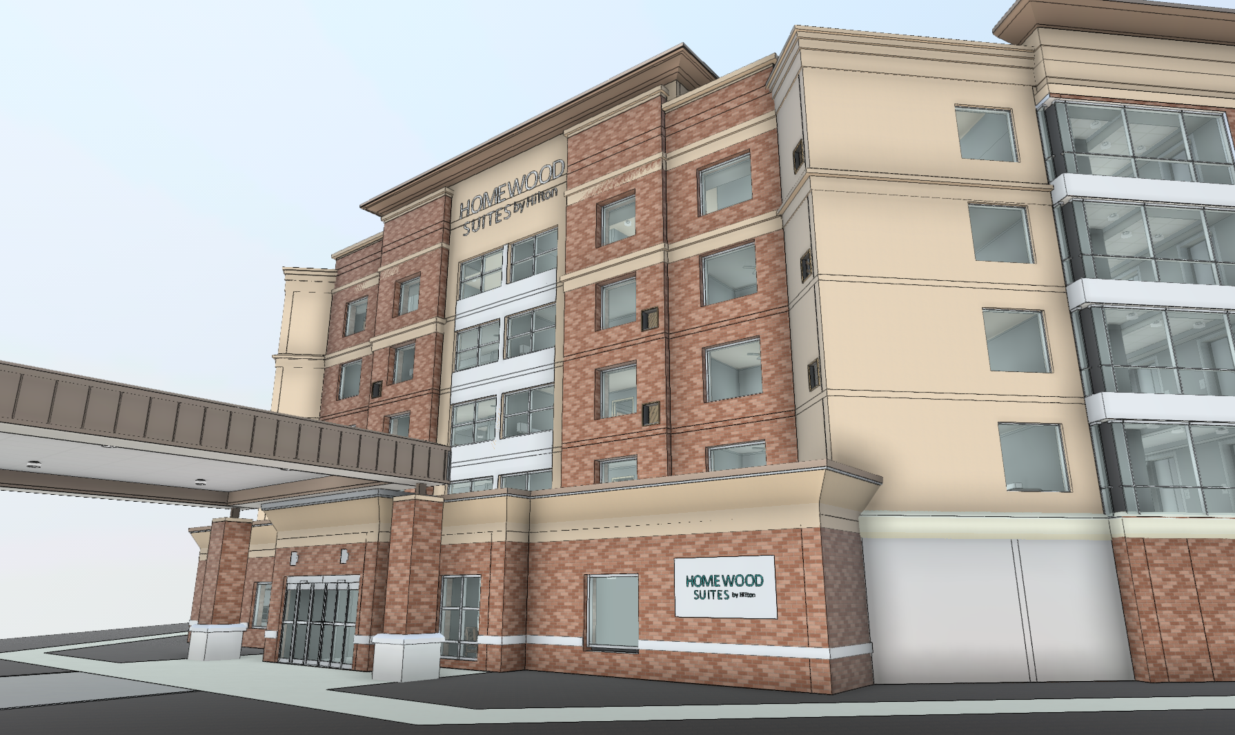
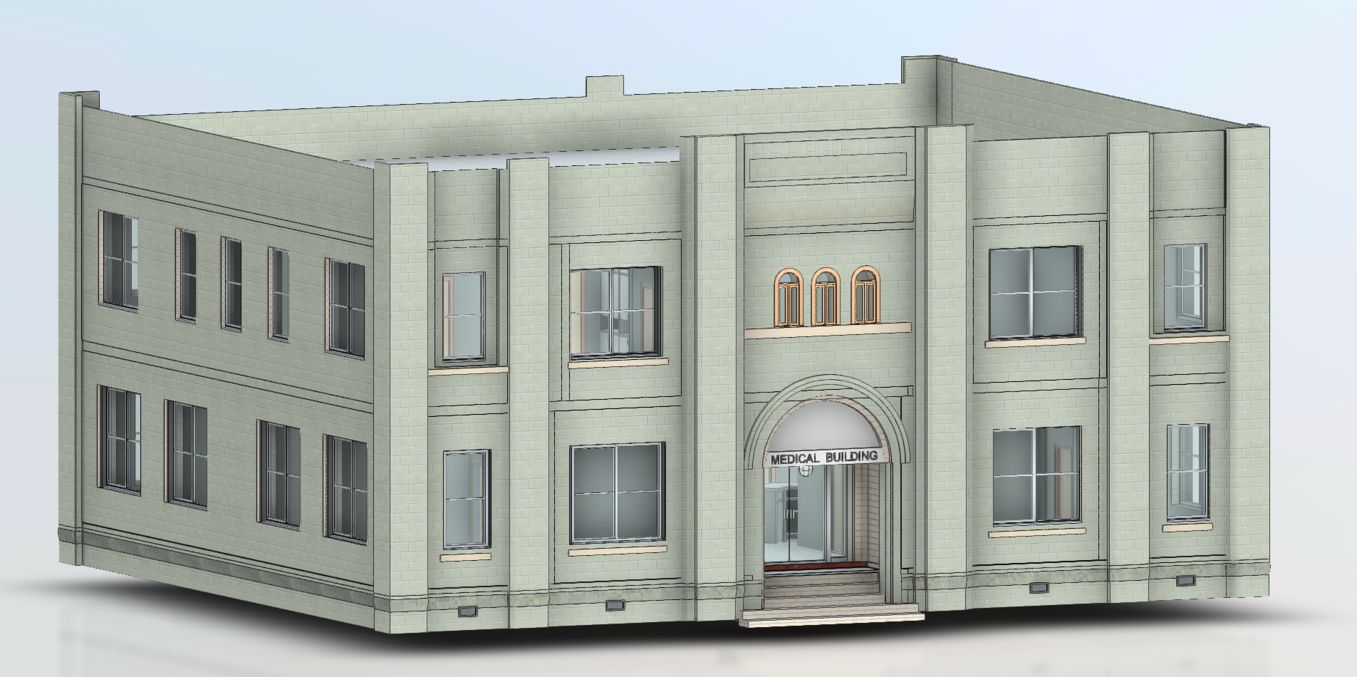
A Revit model of the building as it stands, built to an agreed level of detail for design teams working in BIM from concept design onwards.
A dated, measured record of the building before or after works, for landlords, tenants and owners who need to know exactly what was handed over.
Ductwork, pipework, cable trays and plant recorded where they actually run, so building services engineers design from real routes.
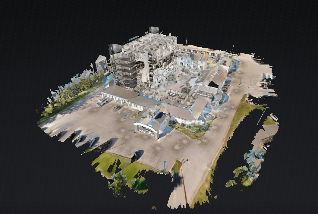
A 3D walk-through of the building, so design teams and clients can check conditions without another trip across London.
GeoMaus keeps project communication direct and practical. Michael Kiernan, owner of GeoMaus, works with clients to define the survey scope, coordinate site capture, and establish the deliverables needed for the project.

LOCATION
Mayfair, London, UK
BUILDING
Multi-storey period building
COVERAGE
Basement to fourth floor, plus roof terrace
SCOPE
Measured building survey, Revit model, floor plans, reflected ceiling plans and sections
GeoMaus surveyed a period building in Mayfair and delivered a consolidated Revit model alongside CAD and PDF drawings. The package includes floor plans, reflected ceiling plans and building sections, recording the relationship between rooms, stairs and the roof terrace for the project team.
Straight answers on listed buildings, RIBA stages and what you receive from a London measured building survey.
The scanner measures millions of points across every room, so the survey shows walls that are out of plumb, floors that fall and ceilings that change height, rather than averaging them out. Drawings and Revit models are checked against the point cloud before delivery, and accuracy requirements can be agreed against your survey specification at the start.
Yes. Laser scanning is non-contact, so nothing is fixed to the historic fabric. The point cloud records mouldings, joinery, window reveals and wall thicknesses, giving your architect and heritage consultant an accurate base for listed building consent drawings and heritage statements.
Ideally at Stage 0 or Stage 1, before feasibility and concept design. Accurate existing drawings at the start mean the design is tested against the real building rather than old plans, and the same measured building survey carries through planning, technical design and the tender package.
Scan to BIM is the process of turning the point cloud into a Revit model of the building as it exists. We agree the level of detail with you up front: a lighter model of walls, floors, roofs and openings for feasibility and concept design, or a more detailed model with structure, MEP and architectural features for coordination. IFC exports are available for teams outside Revit.
Yes. Site days are planned around how the building runs, including early starts, evenings and weekends for shops, restaurants and offices that cannot close. Tell us about access restrictions, building management rules or neighbours when you ask for a quote, and the visit will be booked to fit them.
GeoMaus works across all London boroughs, from Westminster, the City and Camden to Kensington and Chelsea, Islington, Hackney, Southwark and beyond, and out into the Home Counties, including Surrey, Kent, Essex, Hertfordshire, Buckinghamshire and Berkshire. Send us the location and we will confirm.
Michael Kiernan, founder of GeoMaus, runs every project personally, from the first call to handover. With a geodetic engineering background and more than a decade of project experience, he sets the scope, oversees quality control and makes the decisions that affect your programme, while our team carries out the fieldwork and modelling.
Most enquiries get a same-day reply from Michael directly. If your project isn’t a fit for us, he’ll tell you on the call and point you somewhere better.
No sales calls, no automated drip sequences. Michael replies personally to every enquiry usually within a few hours.