Luxury Residential

Parkside, Portland, ME – 4,100 sq. ft. Home Existing Conditions Survey & As-Built Drawings

Existing conditions survey and as-built drawings for a 4,100 sq. ft. home in Parkside, Portland, ME. A design-build firm needed the house measured before planning its renovation. The GeoMaus measured building survey produced an ArchiCAD model, PDF floor plans, reflected ceiling plans, elevations, sections and a site plan, plus the raw point cloud data and a tour.

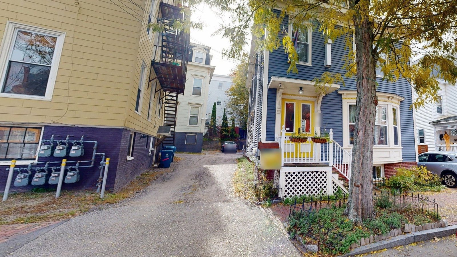
Exterior of a blue three-level clapboard home with a yellow front door and bay window in Portland, ME
Front of the three-level Parkside home, with its yellow entry doors and bay window.
LOCATION(S)

Parkside, Portland, ME

APPROXIMATE SIZE

4,100 sq. ft.

BUILDING TYPE

Luxury Residential

SERVICES: 3D LiDAR Laser Scanning 3D Virtual Tour Architectural CAD Documentation BIM Modelling Measured Building Survey
DELIVERABLES: CAD Drawings Exterior Elevations Floor Plans Full 3D Virtual Tour PDF Drawing Set Reflected Ceiling Plans Registered Point Cloud Sections Site Plan

THE CHALLENGE

Existing Conditions Survey Ahead of a Parkside Home Renovation

A design-build firm planning the renovation of this Parkside home needed measured existing conditions before its designers could test a single change. With demolition and new work to follow, the team wanted the house recorded as it stands, in a form its own designers could open. Projects like this are a steady part of our high-end residential survey work.

The house runs over three levels, from a basement up through the main floor to an attic under the roof. The foundation and framing were still to be confirmed once demolition began, so the record had to capture the walls, floors and roof lines the builders would later open up.

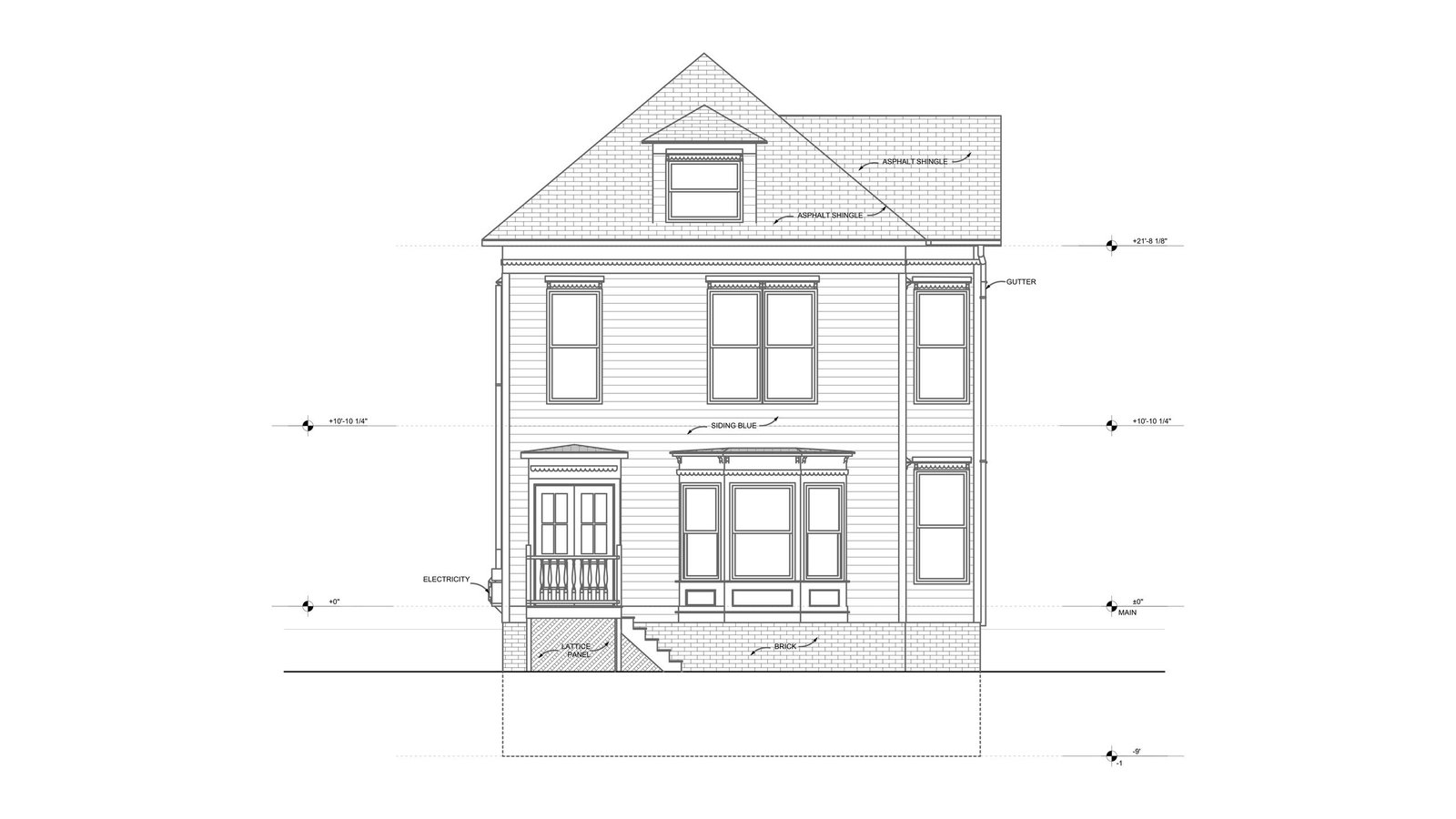
Existing north exterior elevation of a three-level clapboard house with a dormer and bay window
North elevation of the home, from the basement level up to the dormer in the roof.

SCOPE OF WORK

Existing Conditions of a Three-Level Home

GeoMaus was asked to capture the whole house: the basement, the main floor and the attic, plus every exterior face and the lot around the building, so the site plan and elevations could come from the same visit as the interior.

A design-build team prices and plans work from the same drawings, so it needed one reliable record rather than separate notes for each floor. Floor plans and reflected ceiling plans would guide layout and services, while elevations and sections showed how the three levels and the roof relate. That is the as-built documentation a builder needs when renovation starts.

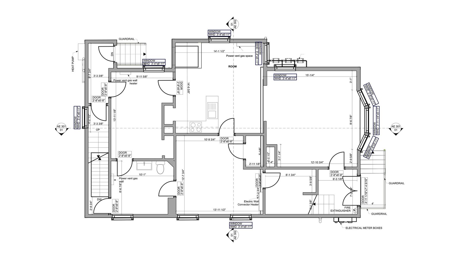
Existing main floor plan of a house showing rooms, stairs, dimensions and a bay window
Main floor plan of the Parkside house, with room dimensions and door positions.

OUR APPROACH

Matterport Capture of the Basement, Main Floor and Attic

A single site visit covered the house with Matterport capture, moving through each room of the basement, then the main floor and the attic, before recording the outside of the building. Once registered, those scans became the modeling dataset and a Matterport 3D tour the firm could walk through from its office.

Modelers then built the house in ArchiCAD from that point cloud, keeping every level and the roof in one model. Because the foundation and framing would only be confirmed once walls were opened, a single measured model gave the team a clear baseline to compare against whatever demolition revealed.

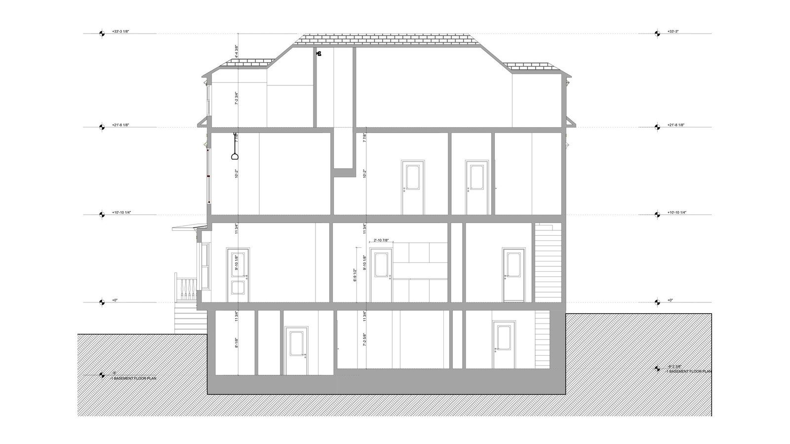
Section drawing through a three-level house from the basement to the attic
Building section cutting through the basement, both main floors and the attic.

THE OUTCOME

ArchiCAD Model and PDF Drawings for the Design-Build Team

The design-build firm received an ArchiCAD model, PDF drawings of every floor and ceiling, the exterior elevations, a building section and the site plan, plus the raw point cloud data and an online tour of every room. Every drawing came from that one model, so the three levels line up with each other.

With the house measured, the team could plan the renovation against the real basement, main floor and attic rather than assumptions, and check proposals before work began on site. The scan-to-BIM modeling also gave the firm a 3D starting point for its proposed scheme.

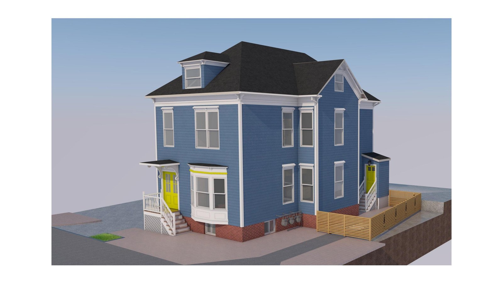
Exterior view of an ArchiCAD model of a blue three-level home with dormers and porches
ArchiCAD model view of the house, showing the porches, dormers and rear fencing.

RECENT WORK

Recent Case Studies

From operational hotels and distribution centres to commercial portfolios and industrial facilities, explore how GeoMaus has helped clients create accurate building documentation while maintaining clear communication, dependable delivery and minimal disruption to operations.
Chapelizod, Dublin – 300 m² End-of-Terrace House Measured Survey & Revit As-Builts

Measured survey and Revit as-builts for a 300 m² end-of-terrace house in Chapelizod, Dublin. Before the owners extended or renovated, their design firm needed the existing floor plans, elevations and sections as Revit files and drawings. GeoMaus captured the house and sloping garden with Matterport and delivered Revit as-builts with PDF drawings and the raw point cloud data.

Bayside, Dublin – Three-Level House Existing Drawings & Revit Model

Existing drawings and a Revit model for a three-level house in Bayside, Dublin. The homeowner’s architects needed the existing conditions measured for a feasibility study ahead of a possible planning application. The measured building survey produced a Revit model plus floor plans, elevations and sections in PDF and DWG, with a site plan.

Measured Survey in Terenure, Co. Dublin

A red-brick, bay-fronted terraced house in Terenure, Co. Dublin, of two storeys plus attic and approximately 1,836 sq ft (171 m²), needed a measured survey before its design team could start an initial feasibility study, with a potential tender package to follow. The client required a complete existing-building record as that first step.

Clontarf, Dublin – 276 m² Semi-Detached House Measured Survey & Scan-to-BIM

Measured survey and scan-to-BIM for a 276 m² semi-detached house in Clontarf, Dublin. A design firm planning an extension or renovation needed a Revit model and drawn copies of the existing plans, elevations and sections. GeoMaus captured the house and side garage with Matterport and supplied a scan-to-BIM Revit model, a PDF set, and the raw point cloud data.

REQUEST A FREE QUOTE

Tell Michael About Your Project

Most enquiries get a same-day reply from Michael directly. If your project isn’t a fit for us, he’ll tell you on the call and point you somewhere better.

No sales calls, no automated drip sequences. Michael replies personally to every enquiry usually within a few hours.