Office Buildings

Meatpacking District, Manhattan, NY – 4,200 sq. ft. Three-Level Office Laser Scanning & Measured Survey

Laser scanning and a measured survey for a 4,200 sq. ft. three-level office in Meatpacking District, Manhattan, NY. A workspace operator planning an office renovation needed Revit and CAD documentation of every floor: floor plans, reflected ceiling plans, structural plans, elevations and sections. GeoMaus delivered as-built documentation for all three floors in Revit, CAD and PDF with the point cloud.

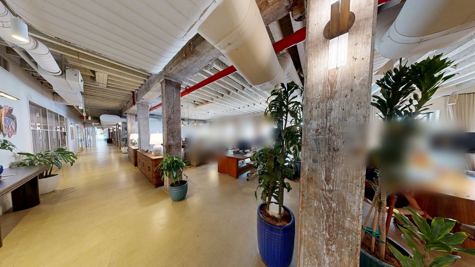
Open-plan office interior with exposed columns, plants, and windows along one wall
Open workspace inside the three-level office, with exposed columns and a long run of windows.
LOCATION(S)

Meatpacking District, Manhattan, NY

APPROXIMATE SIZE

4,200 sq. ft.

BUILDING TYPE

Office Buildings

SERVICES: 3D LiDAR Laser Scanning 3D Virtual Tour Architectural CAD Documentation Measured Building Survey Scan-to-BIM
DELIVERABLES: CAD Drawings Coordinated Revit Model Exterior Elevations Floor Plans Full 3D Virtual Tour PDF Drawing Set Reflected Ceiling Plans Registered Point Cloud Sections Structural Plans

THE CHALLENGE

Manhattan Office Measured Survey Before a Three-Floor Renovation

A workspace operator was planning a renovation across three floors of its office in an older Meatpacking District building. Before design started, it needed existing floor plans, reflected ceiling plans, structural plans, an exterior elevation and sections for every level, in Revit and CAD, so layout, ceiling and structural changes could share one measured base. Multi-level briefs like this are common in our office building surveys.

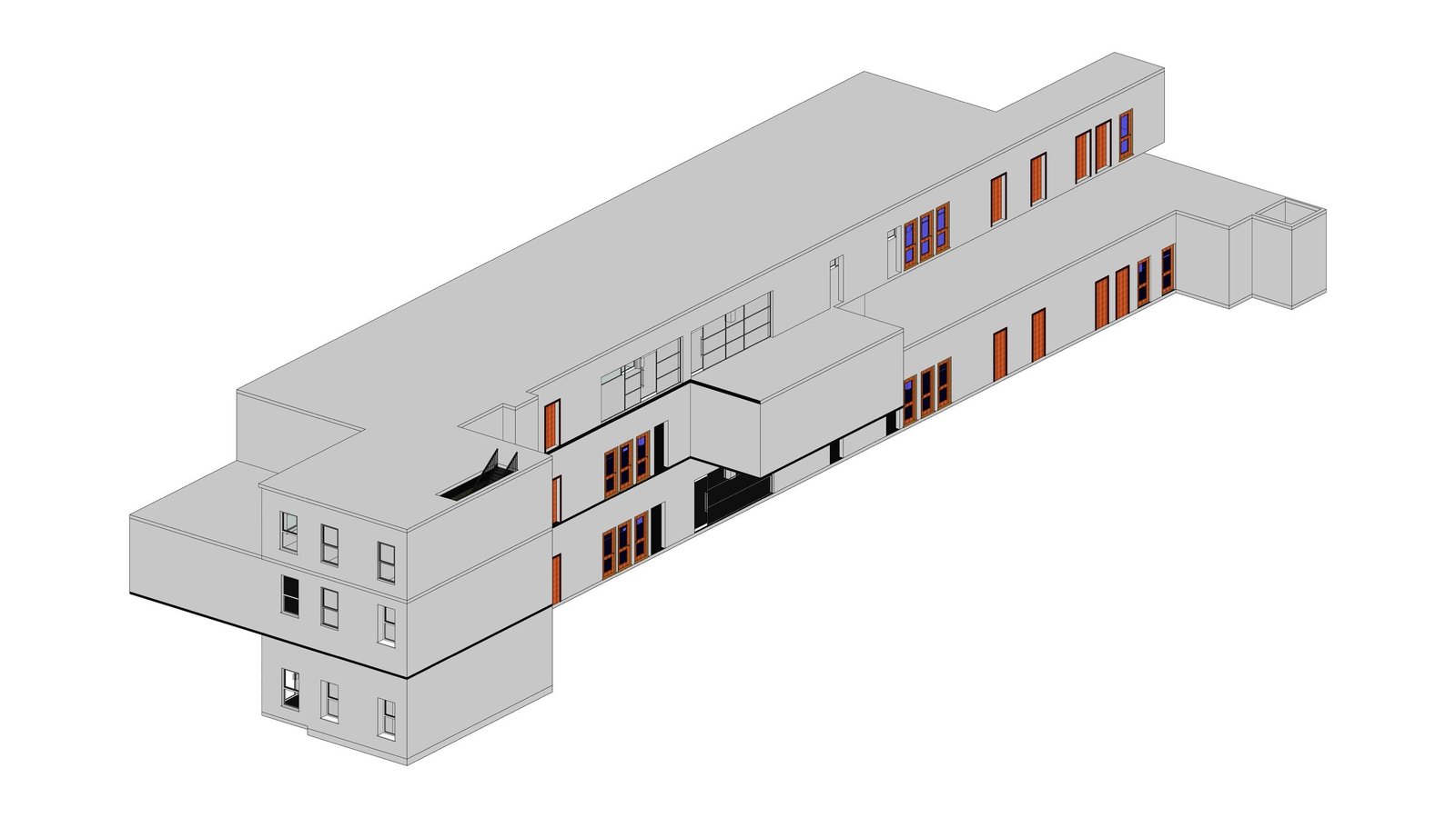
The floors are long and narrow, with column lines running their full length. Level 2 sits at 11′-11″, Level 3 at 23′-6″ and the roof at 34′-2″. Ceiling heights change room by room, from 8′-1″ in the lowest spots to 11′-5″ on the ground floor, and the furnished workspace stayed in place.

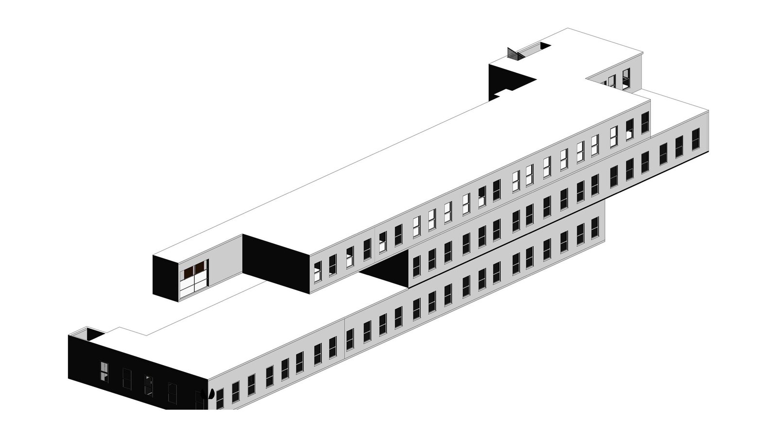
3D model view of a three-level office building with long narrow floors
3D view of the three office levels, showing how the long floors stack above the street.

SCOPE OF WORK

Reflected Ceiling Plans and Structural Plans for Every Floor

The operator asked GeoMaus to capture all three levels: open workspace, enclosed rooms, circulation, stairs and back-of-house areas, plus the street facade. Ceilings were to be recorded room by room on every floor, with columns and beams picked up wherever they were exposed.

It wanted a record its architects and engineers could both use, so layout, ceiling and structural decisions would start from the same numbers. A Revit model from the scan would serve the design team, reflected ceiling plans with heights marked would guide the ceiling work, and structural plans tracing the column grid would show the engineers what they had to work around.

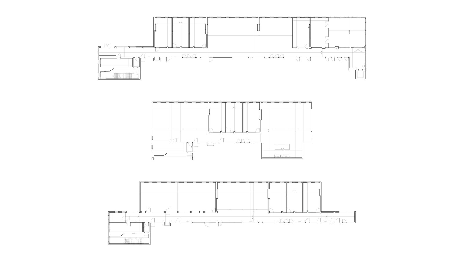
Existing floor plans of three office levels stacked one above another
Floor plans of all three levels, showing the long narrow footprint and column lines.

OUR APPROACH

Laser Scanning Between Desks and Along Column Lines

GeoMaus recorded the three floors and the street front with laser scanning, giving one registered point cloud and a VR tour. The capture worked through each floor in turn, setting positions between desks and along the column lines so the beams, soffits and varied ceilings were recorded despite the furniture.

Ceiling heights were read from the scan room by room rather than assumed from one typical value, because they change from 8′-1″ to 11′-5″ across the floors. Tracing the column grid floor by floor in Revit meant the three levels stack correctly, so a partition or ceiling change planned on Level 3 can be checked against the columns below it.

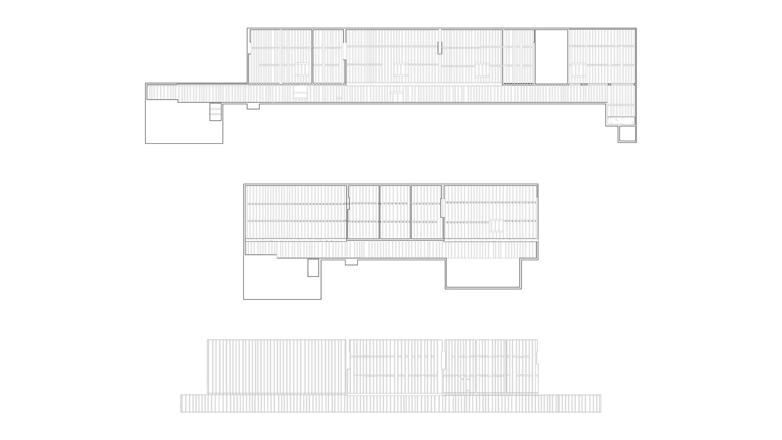
Existing structural plans of a three-level office showing column positions
Structural plans tracing the column grid on each floor, drawn from the scan.

THE OUTCOME

Revit, CAD and PDF Files on One Column Grid

Every format the operator asked for came together: Revit, CAD and PDF, plus the registered scan data and a VR tour, all on the same four level datums. Its design team could plan changes on all three floors at once, checking new layouts against the column grid and ceiling heights as measured. The structural plans give its engineers the column positions before any wall or ceiling moves.

The tour and point cloud gave them a way to check a column or soffit remotely, and the complete package arrived 7–10 days after the site work. This project joins our Manhattan existing conditions surveys.

3D model view of a three-level Manhattan office building from the street side
3D view of the office model from the street side, with all three levels and the roof.

RECENT WORK

Recent Case Studies

From operational hotels and distribution centres to commercial portfolios and industrial facilities, explore how GeoMaus has helped clients create accurate building documentation while maintaining clear communication, dependable delivery and minimal disruption to operations.
East Hampton, NY – 1,946 sq. ft. Home Existing Conditions Survey & Revit As-Builts

Existing conditions survey and Revit as-builts for a 1,946 sq. ft. home in East Hampton, NY. A design firm needed the house measured ahead of renovation design. The GeoMaus measured building survey produced a Revit model, DWG and PDF drawings with floor plans, reflected ceiling plans, elevations and sections, plus point cloud data and a tour.

Times Square NYC – 30,000 Sq. Ft. Office Floor Measured Survey

Full LiDAR capture and scan-to-BIM documentation of a vacant 30,000 sq. ft. office floor in a landmark Times Square building, delivered design-ready with no revisions.

Clontarf, Dublin – 276 m² Semi-Detached House Measured Survey & Scan-to-BIM

Measured survey and scan-to-BIM for a 276 m² semi-detached house in Clontarf, Dublin. A design firm planning an extension or renovation needed a Revit model and drawn copies of the existing plans, elevations and sections. GeoMaus captured the house and side garage with Matterport and supplied a scan-to-BIM Revit model, a PDF set, and the raw point cloud data.

Chapelizod, Dublin – 300 m² End-of-Terrace House Measured Survey & Revit As-Builts

Measured survey and Revit as-builts for a 300 m² end-of-terrace house in Chapelizod, Dublin. Before the owners extended or renovated, their design firm needed the existing floor plans, elevations and sections as Revit files and drawings. GeoMaus captured the house and sloping garden with Matterport and delivered Revit as-builts with PDF drawings and the raw point cloud data.

REQUEST A FREE QUOTE

Tell Michael About Your Project

Most enquiries get a same-day reply from Michael directly. If your project isn’t a fit for us, he’ll tell you on the call and point you somewhere better.

No sales calls, no automated drip sequences. Michael replies personally to every enquiry usually within a few hours.