Luxury Residential

Sonoma, CA – 6,000 Sq. Ft. Multi-Unit Residential & Site Survey

3D laser scanning and scan-to-BIM survey of a 6,000 sq ft multi-unit residential property in Sonoma, CA, combining full building documentation across three floors and a basement with a detailed topographic site survey mapping every existing tree to satisfy zoning and arborist preservation requirements, completed in one day on site.

Multi-Residential Property - Sonoma, CA - Site Survey & BIM Model alongside measured building survey
Multi-Unit Residential in Sonoma, CA
LOCATION(S)

Sonoma, CA

APPROXIMATE SIZE

6,000 sq. ft.

BUILDING TYPE

Luxury Residential

SERVICES: 3D LiDAR Laser Scanning Measured Building Survey Scan-to-BIM Topographic Site Survey
DELIVERABLES: CAD Drawings Coordinated Revit Model Exterior Elevations Floor Plans Reflected Ceiling Plans Registered Point Cloud Sections Site Plan

THE CHALLENGE

A Building Survey and a Landscape Survey in One

A property owner in Sonoma needed full existing-conditions documentation of a 6,000 sq ft residential property spanning three floors and a basement, plus two external units, ahead of a renovation to the existing structure. But the brief didn’t stop at the building.

The property’s land came with an arborist and zoning requirement to preserve the existing trees, which meant the site itself needed the same level of precision as the building  every tree on the property had to be located and sized, alongside a full topographic survey capturing spot heights, the property boundary, water tanks, and outbuildings. Combining a detailed architectural survey with a full landscape and topographic survey in a single scope meant the drafting requirements on this one were considerably more demanding than a typical residential job.

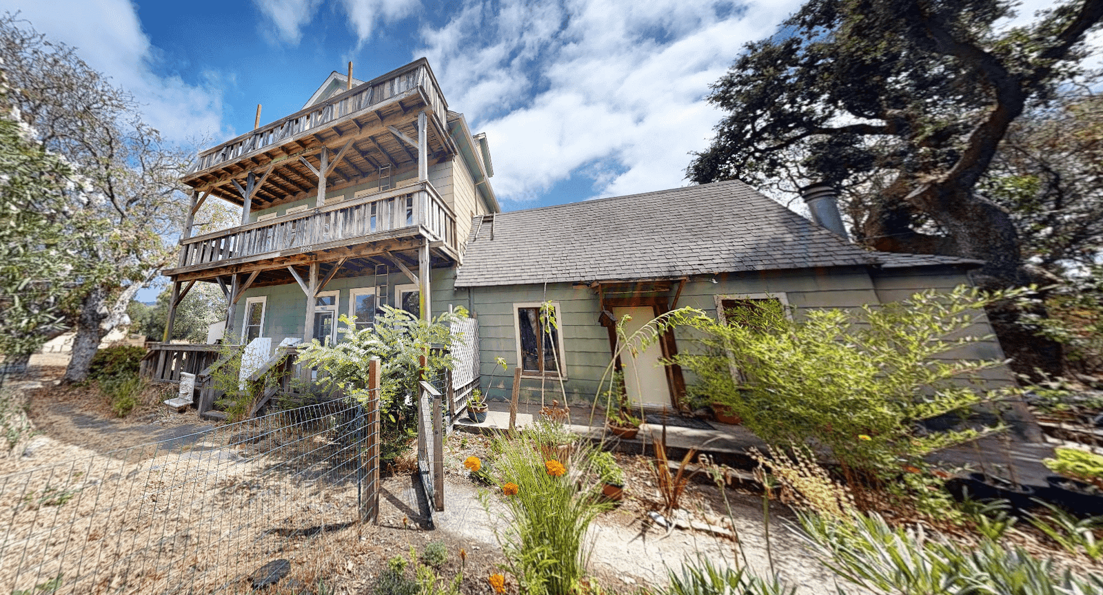
Multi-Residential Property - Sonoma, CA - Site Survey & before the capture snap
The Sonoma property's grounds, including trees subject to preservation requirements.

SCOPE OF WORK

Main Residence Across 3 Floors & a Basement, Plus 2 External Units

The brief covered the full residence across all three floors and the basement, plus the two external units, with full exterior elevations, floor plans, reflected ceiling plans, and sections. Alongside the building, the client needed a complete site plan showing topography with spot heights, the property boundary, all existing trees with trunk and canopy size, water tanks, and outbuildings – precise enough to satisfy the zoning and arborist requirements around tree preservation. All of this was delivered as a coordinated Revit model with full CAD and PDF documentation.

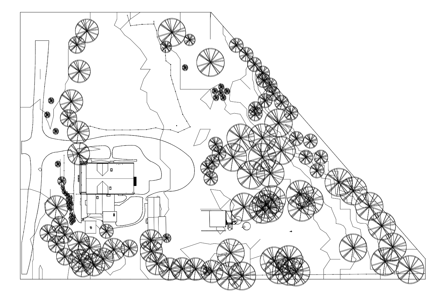
Multi-Residential Property - Sonoma, CA - Topographic survey - Site Survey & before the capture snap
Site plan showing tree locations, spot heights, and property boundary.

OUR APPROACH

Capturing Building and Landscape Together

We captured the full property in a single day on site, recording the residence and both external units with 3D LiDAR scanning at millimetre-level accuracy, alongside a topographic survey of the grounds every tree’s location and approximate size, spot heights across the site, the property boundary, water tanks, and outbuildings.

From there, the drafting work was considerably more involved than a standard residential survey. Our BIM and CAD teams produced a fully coordinated Revit model of the building, complete with reflected ceiling plans, sections, and exterior elevations, alongside a detailed site plan meeting the precision needed for the zoning and arborist tree-preservation requirements. Given the added complexity of coordinating architectural and topographic data to this standard, the drafting phase took three weeks to complete properly.

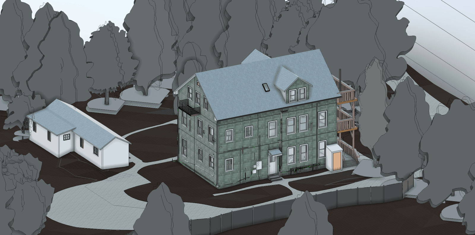
Multi-Residential Property - Sonoma, CA - Scan-to-BIM Revit Model after Laser Scan
Revit model of the residence and surrounding site, including trees.

THE OUTCOME

One Survey, Two Disciplines, Delivered to Standard

Complete as-built documentation, a coordinated Revit model, full CAD floor plans, reflected ceiling plans, sections, and exterior elevation was delivered alongside a detailed site plan meeting the zoning and arborist requirements for tree preservation, from a single day on site.

For the property owner, the value was having both the building and the landscape documented to the standard the project actually needed, in one coordinated survey rather than two separate engagements giving the renovation and any future site planning a single, reliable dataset to work from.

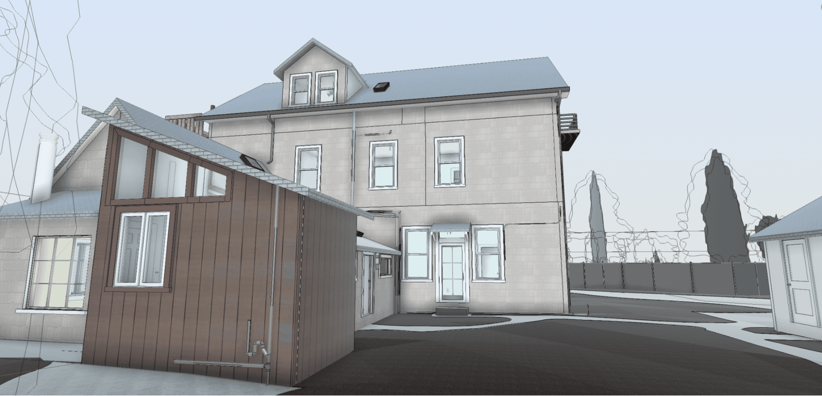
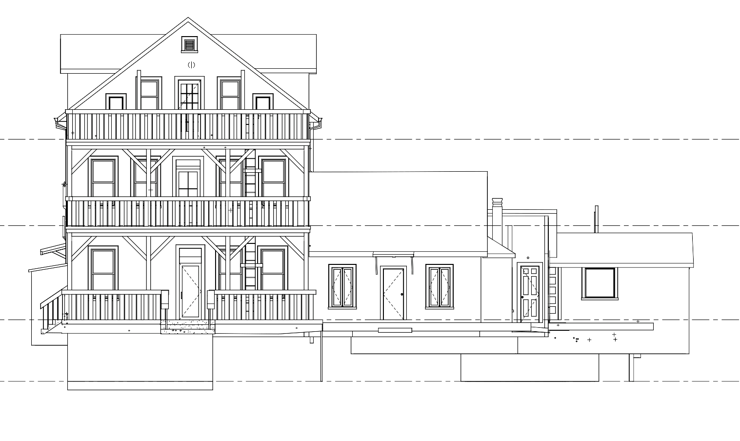
Multi-Residential Property - Sonoma, CA - 2D CAD Drawing & Floor plans
Final external elevation, delivered in Revit and CAD formats.

RECENT WORK

Recent Case Studies

From operational hotels and distribution centres to commercial portfolios and industrial facilities, explore how GeoMaus has helped clients create accurate building documentation while maintaining clear communication, dependable delivery and minimal disruption to operations.
South Orange Village, NJ – 5,500 Sq. Ft. Luxury Residence Scan-to-BIM Survey

3D laser scanning and scan-to-BIM survey of a 5,500 sq ft, 6-bedroom Colonial Revival home in South Orange Village, NJ, capturing every ornate architectural detail – arched entryways, fluted columns, dormers, and decorative trim – to preserve the property’s character through a full renovation, delivered as a coordinated Revit model within 10 days.

Middletown, NY – 127-Room Hotel Full Property Scan-to-BIM Survey

3D laser scanning and scan-to-BIM survey of a 127-room, 4-story Hampton Inn hotel in Middletown, NY, achieving 90% guest room coverage despite the property operating at near full capacity, delivered as full CAD, Revit, and PDF as-builts with a full 3D virtual tour in 3 weeks, to support a brand-compliance renovation and PIP.

Hayward, CA – 4,500 Sq. Ft. Restaurant Scan-to-BIM Survey

3D laser scanning and scan-to-BIM survey of a 4,500 sq ft existing restaurant space in Hayward, CA, delivered as a full coordinated Revit model with floor plans, reflected ceiling plans, and internal and external elevations, completed in just 10 days for a local architect.

Gladeview, Miami, FL – 12-Unit Abandoned Multi-Family Property Scan-to-BIM Survey

3D laser scanning and LOD300 scan-to-BIM survey of an abandoned 12-unit, 6,500 sq ft multi-family property in the Gladeview area of Miami, FL, capturing full interior access across all units and the complete exterior up to the property boundary, delivered as Revit, CAD, and PDF documentation with a full 3D virtual tour in just 12 days, to support a renovation for re-letting.

REQUEST A FREE QUOTE

Tell Michael About Your Project

Most enquiries get a same-day reply from Michael directly. If your project isn’t a fit for us, he’ll tell you on the call and point you somewhere better.

No sales calls, no automated drip sequences. Michael replies personally to every enquiry usually within a few hours.