Luxury Residential

Measured Survey in Crumlin, Dublin: 170 m² Three-Level Home Scan-to-BIM

Measured Survey with scan-to-BIM modeling for a 170 m² home in Crumlin, Dublin. Working for the homeowner, an architecture practice needed the house recorded for a feasibility study ahead of any planning application. Our measured building survey supplied a Revit model, DWG and PDF plans, elevations and sections, and a 3D tour with the raw point cloud data.

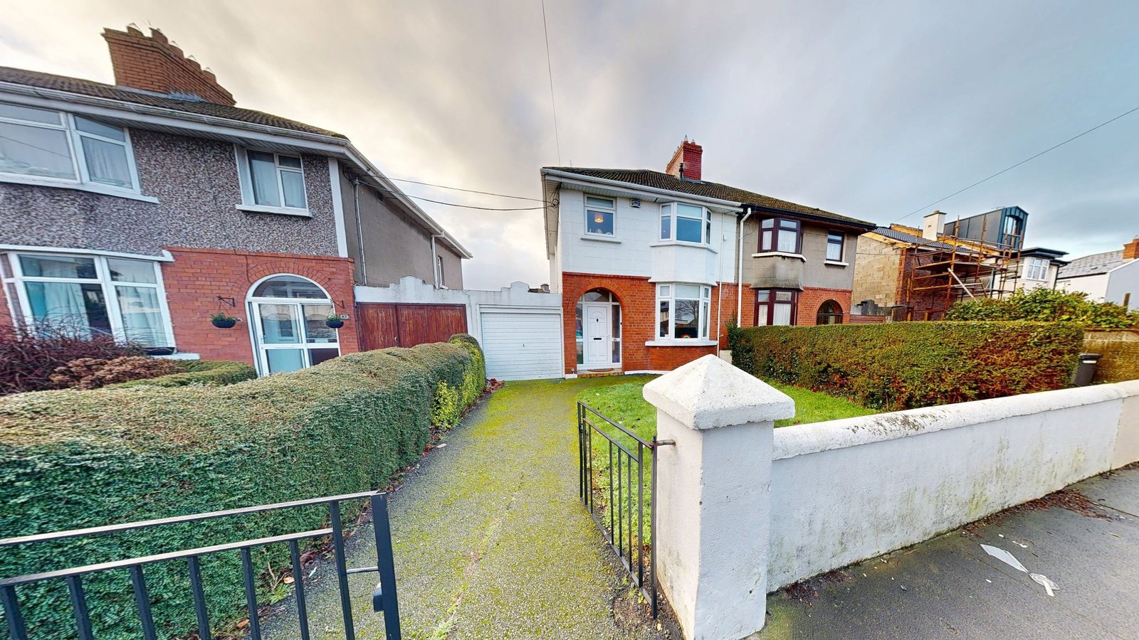
Semi-detached Dublin houses with red brick ground floors, bay windows and front hedges
Red brick and render on the Crumlin home and its neighbor, with bay windows and hedged front plots.
LOCATION(S)

Crumlin, Dublin

APPROXIMATE SIZE

170 m²

BUILDING TYPE

Luxury Residential

SERVICES: 3D LiDAR Laser Scanning 3D Virtual Tour Architectural CAD Documentation Measured Building Survey Scan-to-BIM
DELIVERABLES: CAD Drawings Coordinated Revit Model Exterior Elevations Floor Plans Full 3D Virtual Tour PDF Drawing Set Registered Point Cloud Sections

THE CHALLENGE

Crumlin Home Feasibility Study Built on a Measured Survey

This Crumlin home was the subject of a feasibility study led by an architecture practice working for its owners, with a planning application a possibility if the study pointed that way. The architects wanted the house measured before drawing anything, so they turned to GeoMaus, which handles many measured surveys in Dublin.

The challenge was capturing three levels as one connected building. The ground floor, first floor and attic each needed recording in relation to the others, and the external walls and plot had to be tied in, so that any proposal would be drawn over a single, consistent version of the house.

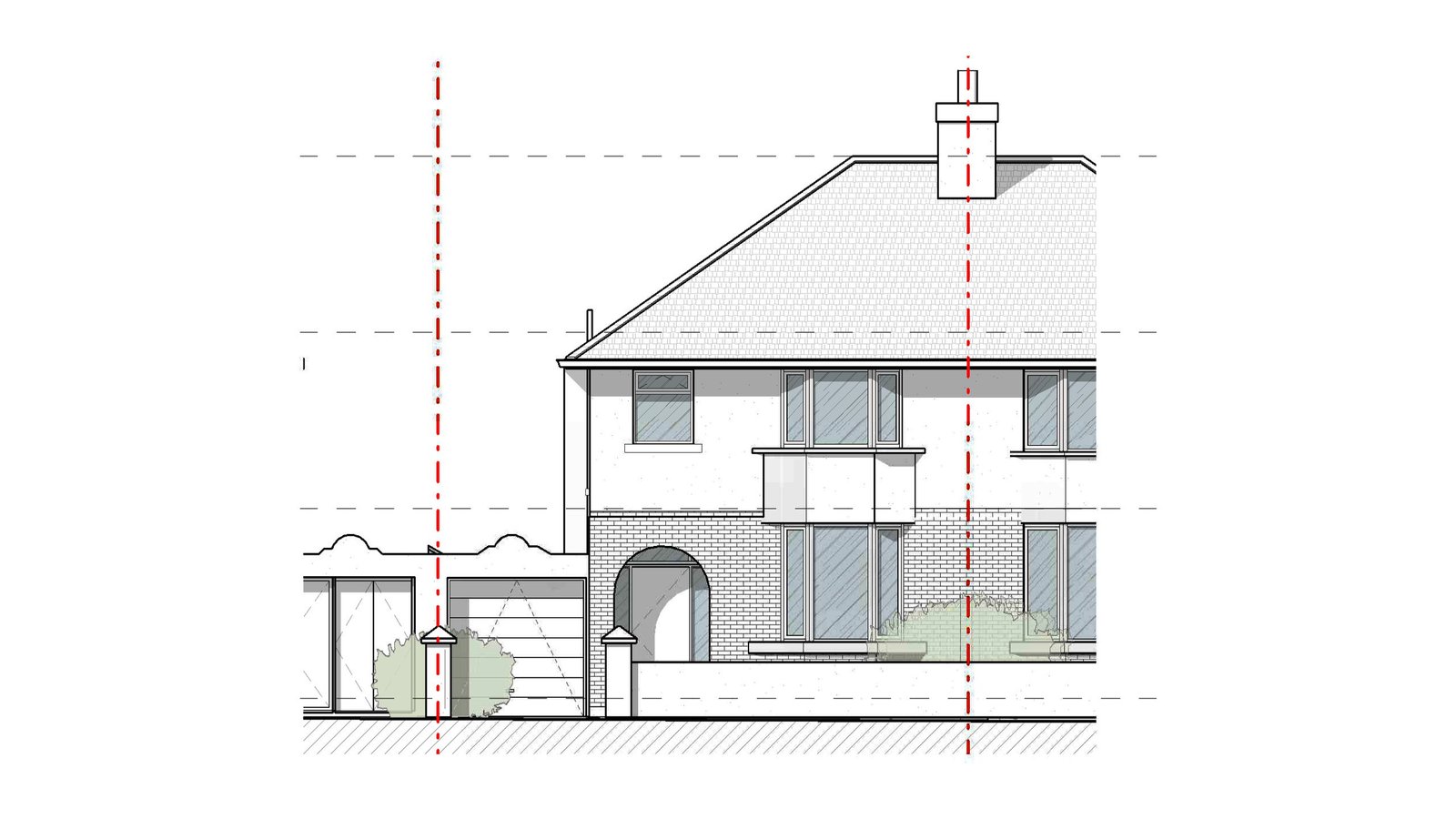
Existing front elevation drawing of a semi-detached house with an arched porch and hipped roof
Front elevation of the Crumlin home, with its arched porch, bay window and hipped roof.

SCOPE OF WORK

Measured Building Survey of Three Levels and the Site

The scope covered every accessible space on the ground floor, the first floor and in the attic, together with the facades and the surrounding plot. From it the architects needed level-by-level floor plans, exterior elevations on every side and sections that run up through all three levels to the roof.

Feasibility options, and any planning drawings that follow, only work when the existing information is consistent. Delivering a Revit model, CAD files and a PDF set from one survey meant the practice held as-built documentation ready for its preferred software, useful from the first option to the last drawing.

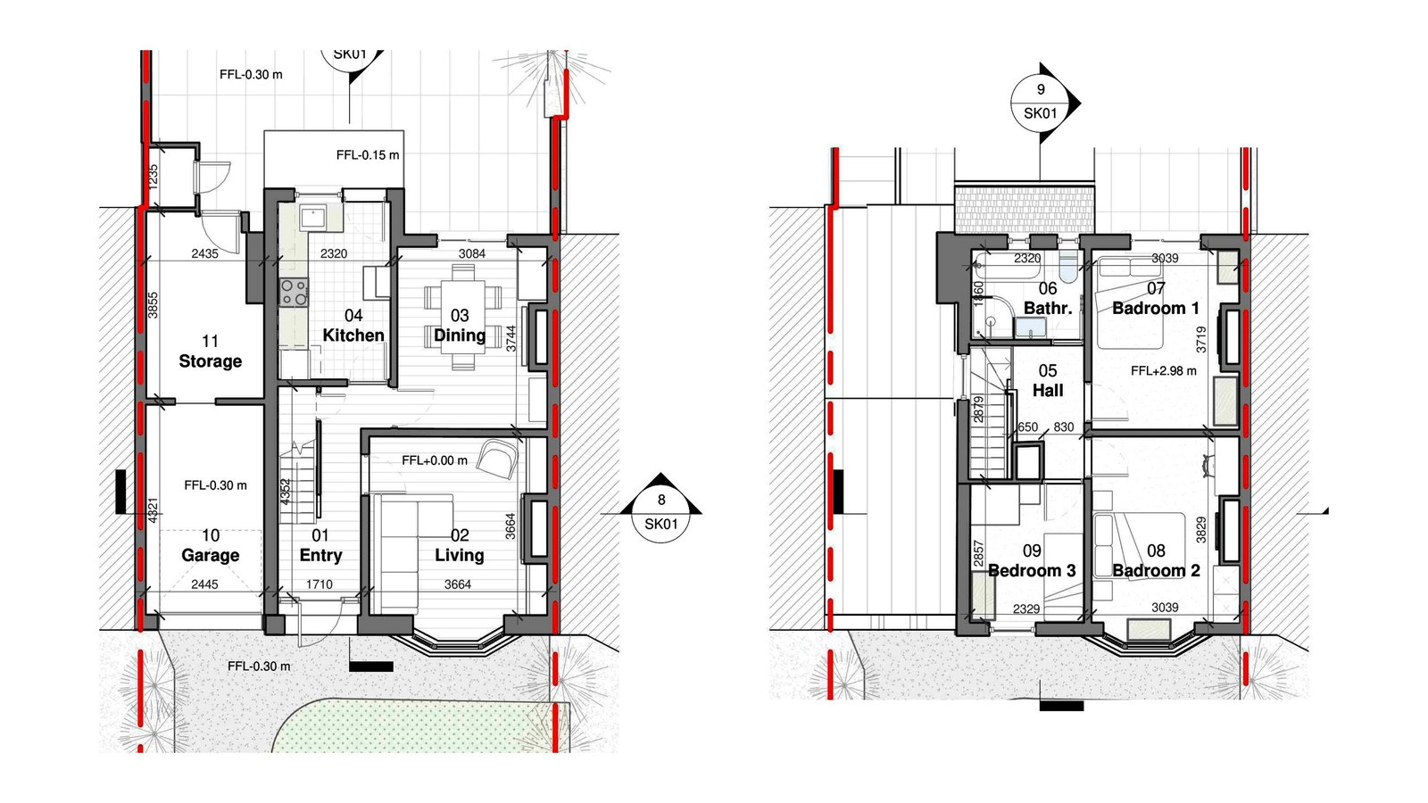
Existing floor plans of a semi-detached Dublin house with a garage and bay windows
Crumlin plans for the ground and first floors, including the garage and the bay rooms.

OUR APPROACH

Matterport Capture and Scan-to-BIM Modeling of the House

On site, LiDAR scanning with the Matterport Pro3 recorded the outside of the home and then each level in turn, starting at the ground floor and finishing in the attic. The capture also produced a Matterport 3D tour the architects could open at any time to recheck a room or a facade.

The individual scans were then registered into one point cloud, which became the measuring base for the Revit model. The model then acted as the single source for the 2D drawings rather than each being drafted on its own, so they agreed with each other and the feasibility options all started from the same figures.

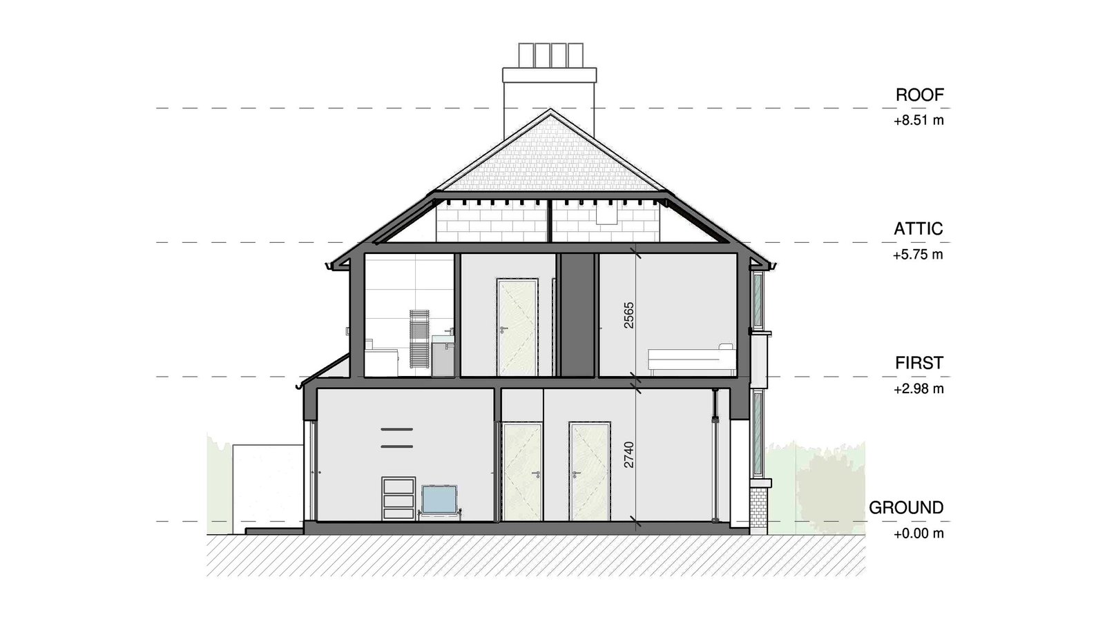
Section drawing of a semi-detached house showing ground floor, first floor and attic levels
Section through the Crumlin home, cutting from the ground floor to the attic under the hipped roof.

THE OUTCOME

Scan-to-BIM Revit Model and DWG Drawings for Planning Options

The architects received the Revit model, CAD drawings in DWG and a PDF set with elevations, sections and floor plans for every level. The raw point cloud data arrived as a single registered file, and the full virtual tour gave them a walkthrough of the house from the same capture.

With the existing home modeled, the practice had a basis for comparing options across all three levels and for preparing planning drawings should the study recommend it. The scan-to-BIM service lets proposals be developed directly on top of the modeled house.

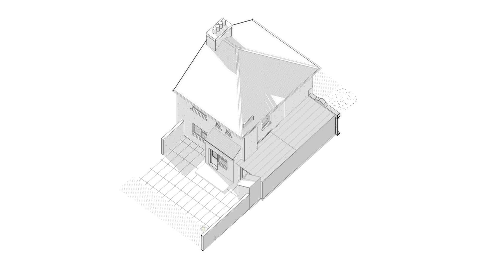
3D Revit model of a semi-detached house with a hipped roof and chimney
Revit model of the Crumlin home, with the hipped roof and the chimney stack.

RECENT WORK

Recent Case Studies

From operational hotels and distribution centres to commercial portfolios and industrial facilities, explore how GeoMaus has helped clients create accurate building documentation while maintaining clear communication, dependable delivery and minimal disruption to operations.
Topographic Survey in Overland Park, KS

A topographic survey for a residential landscape project in Overland Park, Kansas. The landscape architect team required an exterior site plan and four as-built elevations for an estate of about 1.5 to 2 acres in Johnson County, within the Kansas City metro. GeoMaus used exterior Matterport capture to produce the agreed measured record. See our Kansas City as-built documentation page for wider area coverage.

Hudson Yards NYC – 6,000 Sq. Ft. Restaurant Fit-Out Survey

Full LiDAR capture and scan-to-BIM documentation of a 6,000 sq ft commercial space in Hudson Yards, delivered in a 12-day turnaround from a single access window, with detailed reflected ceiling plans to map a complex open-ceiling condition ahead of retrofit.

Gladeview, Miami, FL – 12-Unit Abandoned Multi-Family Property Scan-to-BIM Survey

3D laser scanning and LOD300 scan-to-BIM survey of an abandoned 12-unit, 6,500 sq ft multi-family property in the Gladeview area of Miami, FL, capturing full interior access across all units and the complete exterior up to the property boundary, delivered as Revit, CAD, and PDF documentation with a full 3D virtual tour in just 12 days, to support a renovation for re-letting.

East Sonoma, Sonoma, CA – 5,000 sq. ft. Home Existing Conditions Survey & 3D Revit Model

Existing Conditions Survey and Revit modeling for a 5,000 sq. ft. home in East Sonoma, Sonoma, CA. The project team needed the whole house and its lot recorded as they stand. Our measured building survey delivered a Revit model, CAD and PDF drawings, the raw point cloud data and a 3D tour of every floor.

REQUEST A FREE QUOTE

Tell Michael About Your Project

Most enquiries get a same-day reply from Michael directly. If your project isn’t a fit for us, he’ll tell you on the call and point you somewhere better.

No sales calls, no automated drip sequences. Michael replies personally to every enquiry usually within a few hours.